Collections Map London 1812 – Wood Surname of Essex

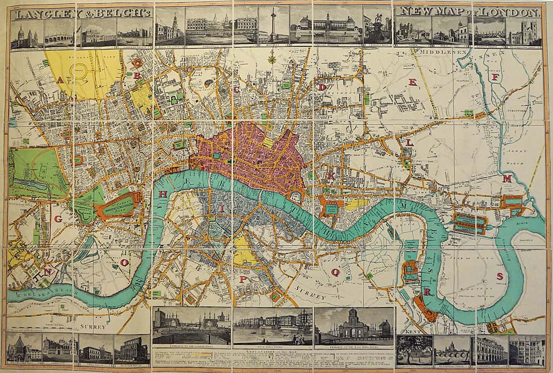
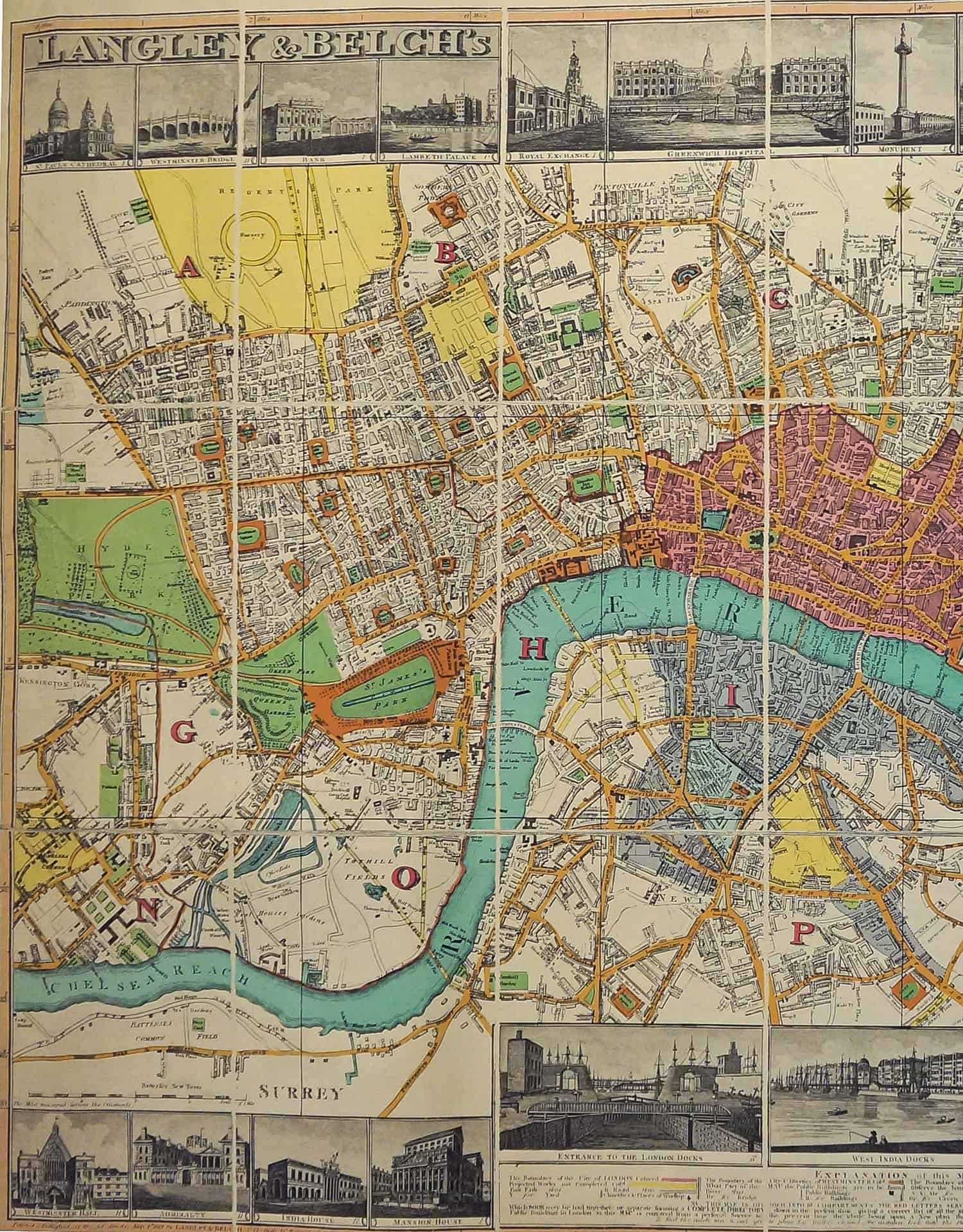
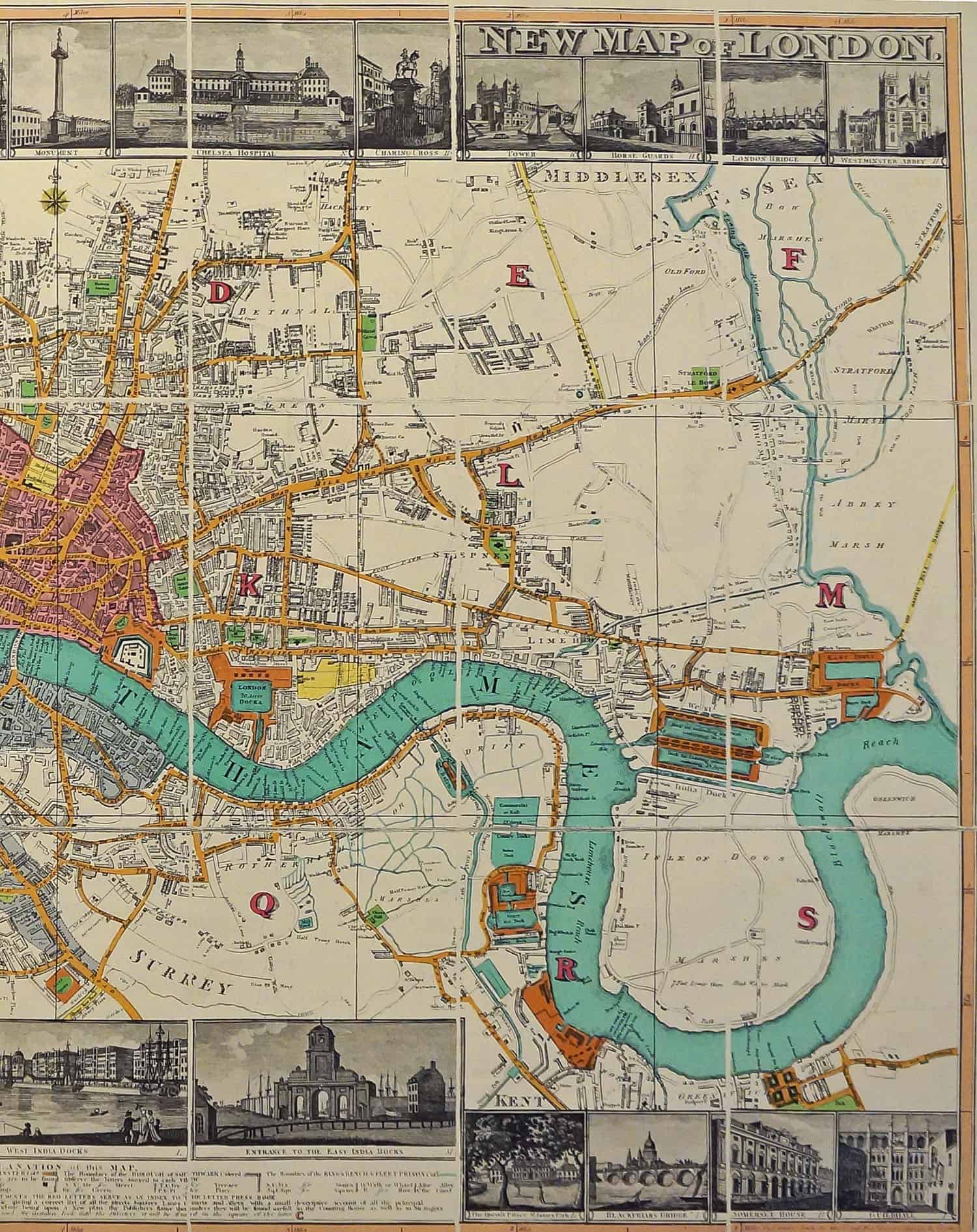
Map of London by Langley & Belch

Langley & Belch’s New Map of London was first published 1 May 1812.  This map is a photograph of a version of their map published in 1819 as a foldout.

Left Side of Map

Side A 1500 wide of 1812 map of London. Main streets are colored. Sketches of famous locations form a ribbon at the bottom of the map.

Right Side of Map

Side B 1500 wide of 1812 map of London. Main streets are colored. Sketches of famous locations form a ribbon at the bottom of the map.


Back to Collections Page